
Equator Line in Kenya: Towns It Crosses and Where to Visit
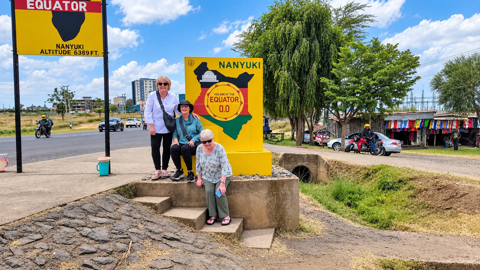
Yes, the equator line in Kenya is real. It crosses the country from west to east at latitude 0°. The towns most often named on the line are Maseno, Timboroa, Mogotio and Nanyuki. Nyahururu, Meru and the Ol Pejeta Conservancy sit on or very close to it. You can stand with one foot in each hemisphere at several marked spots, and many make an easy stop on a Kenya safari.
Equator line in Kenya at a glance
- Latitude: 0°, which divides the Northern and Southern hemispheres
- Does it pass through Kenya? Yes, from the Lake Victoria region in the west to the east
- Towns on or near the line: Maseno, Timboroa, Mogotio, Nyahururu, Nanyuki and Meru
- Best-known marker: the equator sign beside the A2 road at Nanyuki
- Other markers: Maseno (near Kisumu), Mogotio and Timboroa
- Easy day trip from: Nairobi (Nanyuki and Laikipia), Kisumu (Maseno) and Eldoret or Nakuru (Timboroa)
- What you can do: take photos, see water demonstrations and collect certificates
- Best for: families, road-trippers, students and first-time visitors
Does the equator pass through Kenya?
Yes. Kenya is one of a handful of African countries the equator crosses. The line is the imaginary circle around the middle of the Earth at 0° latitude. North of it is the Northern Hemisphere. South of it is the Southern Hemisphere.
In Kenya the line runs from the Lake Victoria area in the west, across the Rift Valley and the Laikipia Plateau, and on towards the east. It passes close to Mount Kenya. The mountain's peaks sit just south of the line, and the foothill towns lie close to it.
So Kenya has places in both hemispheres. Nairobi is south of the equator, at about 1° S. Nanyuki and Meru are just north of it.
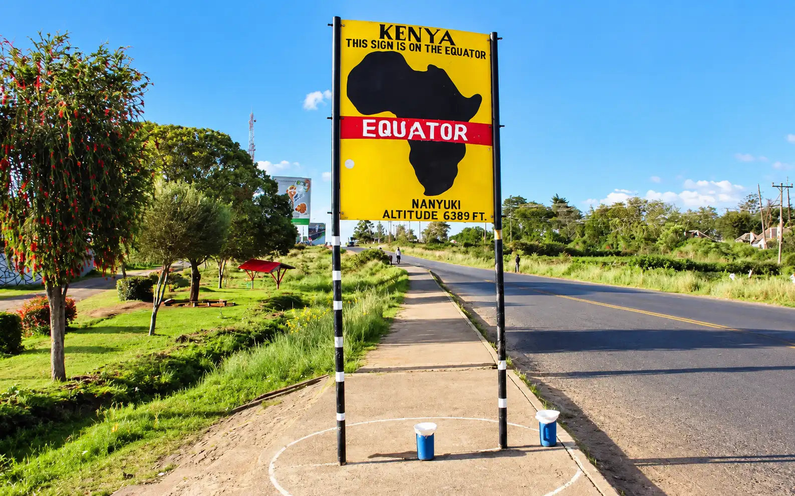
The line itself is not painted on the ground. Local councils and tourism groups put up signs, monuments and markers at the points where main roads cross it.
Towns crossed by the equator in Kenya
Here is a list of the towns and places on or very close to the equator line in Kenya, listed from west to east. Exact positions vary by a few kilometres between sources, so treat the "on the line" label as a guide.
Town or place | County or region | Notes |
|---|---|---|
Maseno | Kisumu County | Equator monument and markers, about 25 km from Kisumu |
Timboroa | Baringo and Uasin Gishu border | On the Nairobi–Eldoret highway. High, cool and often misty |
Mogotio | Baringo County | Small town with an equator marker |
Nyahururu | Laikipia County | Very close to the line, near Thomson's Falls |
Nanyuki | Laikipia County | The best-known marker, beside the A2 road |
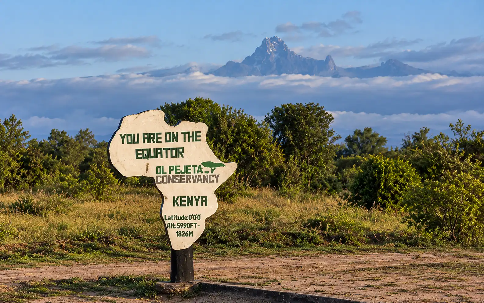
Laikipia County | The line passes through the conservancy. Equator crossing tours are offered | |
Meru | Meru County | A few kilometres north of the line |
Which is the best-known stop? Nanyuki. It lies at about 0°01' N, so the line runs through the south of town. The big sign beside the A2 road is Kenya's most photographed equator marker.
Sources differ on how far the line is from the centre of Nanyuki, with figures from about 1 km to about 6 km, so ask a local guide for the marker's exact spot.
Where to stand on the equator line in Kenya
- Nanyuki (Laikipia): the easiest and most popular stop. It is about three hours by road from Nairobi. The sign sits beside the A2 road, and roadside guides offer demonstrations. It fits neatly on a trip to Laikipia or Mount Kenya.
- Ol Pejeta Conservancy (Laikipia): the line passes through the conservancy. Guided equator crossing tours are offered, and you can combine them with a game drive.
- Maseno (near Kisumu): an equator monument and markers about 25 km from Kisumu. A good stop on a western Kenya trip.
- Timboroa (Rift Valley): on the Nairobi–Eldoret highway. It is one of the cooler and higher places on the line, so carry a jacket.
- Mogotio (Baringo): a small town with a marker, handy for travellers heading to Lake Baringo or Lake Bogoria.
Tip: markers are signs, not exact survey points. Use a phone GPS app to find 0° 00' if you want a precise photo.
How to see the equator line in Kenya
There is no natural line on the ground. You see the equator through signs, markers and a bit of help from your phone. Follow these steps:
- Pick a marked stop. Nanyuki, Maseno, Timboroa and Mogotio have signs or monuments. Ol Pejeta offers guided crossings.
- Look for the sign. Most sites have a large board that reads "Equator" with 0° on it. Many also paint a line across the road or the ground.
- Check your phone. Open a map or GPS app and watch the latitude. Walk until it reads 0° 00' 00". Signs are placed by hand, so the true line can sit a little to one side.
- Ask a local guide. Guides at the stops know where the line runs and will show you where each hemisphere starts.
- Step across. Put one foot on each side. You are now standing in both hemispheres.
- Take your photo. Stand beside the sign so the lettering shows.
Go in the morning for the best light and the fewest crowds.
How the equator experiment is done
The equator experiment is a simple water demonstration. A guide shows you water draining in one direction north of the line, the other direction south of it, and straight down on the line. Here is how it usually goes:
- Set up. The guide places a basin or bucket with a small hole in the base on a stand. A plug blocks the hole while it fills with water.
- Add markers. The guide drops in a few leaves or matchsticks. They make the swirl easy to see.
- Start on the line. Standing on the equator, the guide pulls the plug. The water drains straight down with no clear spin.
- Move a few metres north. The guide repeats the test. The leaves appear to spin anticlockwise.
- Move a few metres south. The guide repeats it again. The leaves appear to spin clockwise.
- Compare. The guide explains that the Coriolis effect, which comes from the Earth's rotation, bends flowing water in opposite directions in each hemisphere.
What science says. The Coriolis effect is real, but it is far too weak to steer water in a small basin. The swirl you see comes from how the basin was filled, the shape of the hole and the way the guide pours or moves the water. It is a fun show, not scientific proof. The effect does shape large systems such as hurricanes and ocean currents.
Tips for the demonstration:
- Agree the fee with the guide before the show starts.
- Take a video, because the swirl is quick.
- Ask children to predict the direction before the guide pours.
What to do at the equator line in Kenya
Most stops are short, about 20 to 40 minutes. A typical visit includes these:
- The photo: stand with one foot on each side of the line.
- The water demonstration: a guide pours water through a basin on each side of the line and shows it draining in different directions.
- The certificate: many sites hand out a certificate to say you crossed.
- Local crafts: roadside stalls sell carvings, baskets and souvenirs.
Be aware of the science. The water demonstration is a fun show, not real proof. The Coriolis effect is far too weak to steer water in a small basin, and guides can make the water swirl either way. The "balancing an egg at noon" trick is a myth too.
Guides may ask for a small fee for demonstrations. Agree the price first.
Safari and trip ideas near the equator line in Kenya
The best equator stops are in or near Laikipia, one of Kenya's best wildlife regions. That makes it simple to add the line to a safari.
- Laikipia and Mount Kenya (3 to 4 days): stay in a Laikipia conservancy. Enjoy game drives and walks, then stop at the Nanyuki marker on the way.
- Ol Pejeta and Samburu (5 to 6 days): cross the line, then continue north to see the Special Five animals in Kenya.
- Laikipia and Masai Mara (7 to 9 days): pair a quiet northern stay with the Big Five in the Mara.
- Western Kenya loop: stop at Timboroa and Maseno on the way between Nairobi, Eldoret and Kisumu.
Olengugih Safaris can add an equator stop to any itinerary and arrange your guide and transport.
Best time to visit the equator line in Kenya and how to get there
You can visit all year, because the line sits at the same place in every season. Dry months give the clearest skies and easiest roads. These months are roughly January to March and June to October. The long rains, around March to May, and the short rains, around October to November, can bring mud and cloud.
Highland stops such as Nanyuki and Timboroa can be cool and breezy. Carry a light jacket.
- To Nanyuki: about three hours by road from Nairobi, or a short flight to Nanyuki airstrip.
- To Maseno: about 25 km from Kisumu by road.
- To Timboroa: on the Nairobi–Eldoret highway.
Times are approximate and depend on traffic.
Frequently asked questions about the equator line in Kenya
Does the equator pass through Kenya? Yes. The equator line crosses Kenya from the Lake Victoria region in the west towards the east, passing through the Rift Valley and Laikipia.
Which towns are crossed by the equator in Kenya? The towns most often listed are Maseno, Timboroa, Mogotio and Nanyuki. Nyahururu and Meru lie on or very close to the line, and the Ol Pejeta Conservancy sits on it.
Where is the equator line in Kenya? The easiest places to see it are Nanyuki beside the A2 road, Maseno near Kisumu, Timboroa on the Nairobi–Eldoret highway and Mogotio in Baringo County.
Which Kenyan town is most famous for the equator? Nanyuki. Its sign is the most photographed equator marker in Kenya.
Is Nairobi on the equator? No. Nairobi is about 1° south of the equator, in the Southern Hemisphere.
Does the equator pass through Mount Kenya? It passes very close. Mount Kenya's peaks lie just south of the line, and the foothill towns on its northern side, such as Nanyuki, lie just north.
Is Meru on the equator? Almost. Meru town is a few kilometres north of the line.
How long does a stop at the equator take? Usually 20 to 40 minutes for photos, a demonstration and a certificate.
Is the water draining demonstration real? It is a fun show, not scientific proof. The Coriolis effect is too weak to affect water in a small basin.
Can I combine the equator with a safari? Yes. Nanyuki and Ol Pejeta are in Laikipia, so the line fits easily into a Laikipia, Samburu or Masai Mara trip.
Add the equator line in Kenya to your safari
Tell us your travel dates, group size and interests. We will build an itinerary that includes the equator stop and send you a free quote. Contact Olengugih Safaris to start planning.